Tiedosto:Africa-countries-northern.png
Siirry navigaatioon
Siirry hakuun
Tarkempaa kuvaa ei ole saatavilla.
Africa-countries-northern.png (360 × 392 kuvapistettä, 10 KiB, MIME-tyyppi: image/png)
| Tämä tiedosto on tiedostotietokanta Wikimedia Commonsista. Tiedot kuvaussivulta näkyvät alla. |  |
Tiedoston kuvaussivu Commonsissa |

|
Tästä tiedostosta on saatavilla myös SVG-versio eli vektorigrafiikkatiedosto. SVG-versiota tulisi suosia, mikäli se on laadultaan tätä rasterikuvaa parempi.
File:Africa-countries-northern.png → File:Africa-countries-northern.svg
|
 |
Yhteenveto
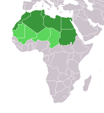
English: Map of countries in geo-political North Africa — as considered by the U.N.
- Credits
from en:Image:Africa-countries-northern.png

|
Voit kopioida, levittää ja/tai muuttaa tätä asiakirjaa GNU Free Documentation License -lisenssin version 1.2 tai minkä tahansa Free Software Foundationin julkaiseman myöhemmän version ehtojen alaisena; ei koske muuttumattomia kohtia, etukannen tekstejä eikä takakannen tekstejä. Kopio tästä lisenssistä on saatavilla osiossa GNU Free Documentation License. |
| Tämä tiedosto on lisensoitu Creative Commons Nimeä-JaaSamoin 3.0 Ei sovitettu -lisenssillä. | ||
| ||
| Lisensointimerkintä lisätiin tähän tiedostoon osana GFDL-lisensointipäivitystä. |
Tiedoston historia
Päiväystä napsauttamalla näet, millainen tiedosto oli kyseisellä hetkellä.
| Päiväys | Pienoiskuva | Koko | Käyttäjä | Kommentti | |
|---|---|---|---|---|---|
| nykyinen | 17. maaliskuuta 2018 kello 18.22 | | 360 × 392 (10 KiB) | Maphobbyist | Montenegro border |
| 1. huhtikuuta 2016 kello 00.00 |  | 360 × 392 (10 KiB) | Fry1989 | Reverted to version as of 16:12, 13 January 2014 (UTC) | |
| 7. marraskuuta 2015 kello 12.37 |  | 360 × 392 (10 KiB) | Hpyounes | correction | |
| 13. tammikuuta 2014 kello 19.12 |  | 360 × 392 (10 KiB) | VVVF | See http://unstats.un.org/unsd/methods/m49/m49regin.htm | |
| 13. tammikuuta 2014 kello 18.59 |  | 360 × 392 (13 KiB) | VVVF | Reverted to version as of 20:15, 9 July 2011. See http://unstats.un.org/unsd/methods/m49/m49regin.htm | |
| 20. heinäkuuta 2011 kello 15.47 |  | 360 × 392 (7 KiB) | Kahusi | See http://unstats.un.org/unsd/methods/m49/m49regin.htm | |
| 9. heinäkuuta 2011 kello 23.15 |  | 360 × 392 (13 KiB) | Maphobbyist | South Sudan has become independent on July 9, 2011. Sudan and South Sudan are shown with the new international border between them. | |
| 5. toukokuuta 2006 kello 14.13 |  | 360 × 392 (4 KiB) | Hautala | optimized with png | |
| 20. huhtikuuta 2005 kello 19.30 |  | 360 × 392 (14 KiB) | Yonghokim | map of countries in Northern Africa. from en:Image:Africa-countries-northern.png {{GFDL}} |
Tiedoston käyttö
Tätä tiedostoa ei käytetä millään sivulla.
Tiedoston järjestelmänlaajuinen käyttö
Seuraavat muut wikit käyttävät tätä tiedostoa:
- Käyttö kohteessa ce.wikipedia.org
- Käyttö kohteessa es.wikipedia.org
- Käyttö kohteessa fr.wikipedia.org
- Käyttö kohteessa he.wikipedia.org
- Käyttö kohteessa ru.wikipedia.org
- Käyttö kohteessa sc.wikipedia.org
- Käyttö kohteessa sv.wikinews.org